LiDAR Best Practices for Archaeology Practitioners
The amount of LiDAR coverage for the Earth’s surface has rapidly increased over the past few years, and a number of scientific disciplines are taking advantage of this increased availability of laser-derived data. Cultural heritage and archeology practitioners are no different, and the increased availability of LiDAR data is revolutionizing research in these fields. This trend is becoming common in the industry for a few reasons. First, LiDAR data is cheap or even free in many areas. More importantly, we are seeing an increase in LiDAR incorporated into archeological applications because the detail and resolution of the data allows practitioners to observe features in the landscape that were previously undetectable using conventional survey methods.
Willem Beex is an archeologist from the University of Amsterdam and the founder of BEEX, a company that provides technological solutions for cultural heritage research projects. Beex indicates that there is a need within the archeology industry to define the best practices for how LiDAR data should be applied by practitioners to their projects. In his recent article titled Lessons from LiDAR data use in the Netherlands, Beex compiled a set of the best practices geared towards guiding these types of professionals and to help them avoid “…obvious mistakes when interpreting LiDAR data.”
In the article, Beex discusses how professionals should always remember the issues inherent to LiDAR data in an archaeological context. He provides a “checklist” that scholars can use when undergoing any research project that utilizes point cloud data.
What are common issues inherent to LiDAR data?
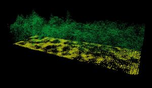
- Gaps in LiDAR datasets are common
- Understanding the environmnetal factors that cause gaps can save time during data collection
- Laser scanners are not 100% accurate
- It is important to validate the classifications within your dataset
- The density of the data affects one’s ability to detect features
- The gridding algorithm used to grid data needs to be carefully selected when interpolating LiDAR data to create surfaces
From the above list, selecting the correct gridding algorithm is most notable for Surfer users. Beex uses Surfer to grid and create 3D surface maps from LiDAR data, and he outlines how using different gridding algorithms will result in very different surfaces.
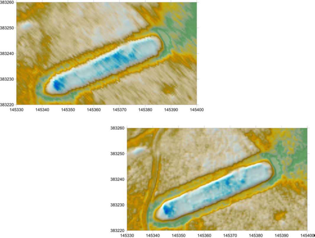
His recommendation for the most accurate surface? Utilize the Kriging method and elongate the search neighborhood.
By stretching the search neighborhood and testing its affect on your dataset you can generate a model that is more representative of the Earth’s surface than utilizing the default search parameters with Kriging. The images to the right are taken from Beex’s article and demonstrate the differences.
LiDAR Best Practices Checklist for Archeologists
You may find Williem Beex’s best practices checklist the most useful aspect of this blog. We would recommend anyone planning to grid a surface from LiDAR data take these five points into consideration:
- Always check for the presence of gaps in the data.
- Always verify the classification of your data.
- Always check the density of the data versus the size of the detected features.
- Always note which algorithms and variables were used in gridding.
- Always ground-truth the results in the field post processing.


